Map your stops, time your start around the weather, and get every waypoint onto your Wahoo, Garmin, Hammerhead or COROS - exactly as you set it up. In your browser, free.
✓ No sign-up ✓ Works in your browser ✓ Free forever
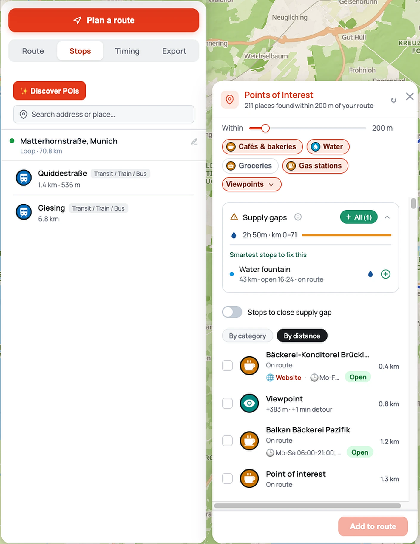
VeloPin finds cafés, water sources, and fuel within reach of your route and tells you which are open when you'll arrive. Never bonk. Never detour for a closed café.
Ride Radar forecasts rain, headwind, and daylight along your actual route - not a city average - and picks the departure time that dodges the worst. Right stops. Right window. Maximum tailwind.
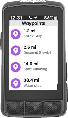
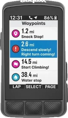
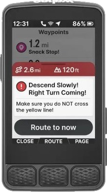
What you plan is what you get. Not a generic purple pin - the right icon, the right name, the right note, on your Wahoo, Garmin, Hammerhead or COROS. The only tool that handles all four.
Drag in a GPX from Komoot or Strava, or plan a new route from scratch with the built-in route planner. Your track and all waypoints load instantly on an interactive map.
Edit waypoints, discover nearby cafés and water, check the Ride Radar weather window, and see the surface breakdown - all before you leave home.
Export a device-optimised GPX, or scan the QR code to send it straight to your phone. Every waypoint arrives with the right icon, name and note.
Each head unit handles GPX waypoints differently. VeloPin knows every quirk - so you get the right icon, name, and note on whichever computer you ride.
Also compatible with RideWithGPS, Komoot, and any GPX-capable device.
Scenic overlooks, landmarks and sights along your line - the reasons the ride is worth it.
Spot stations to reach the start, bail early, or plan a point-to-point ride.
Cafés, water, groceries and fuel along the way, filtered by a distance slider.
Supply-gap detection flags the empty stretches and suggests the smartest stops to fill them.
Every café, water stop, summit, and shelter mapped to the matching icon on Wahoo, Karoo, COROS or Garmin - never a generic pin.
Search for cafés, water sources, bike shops, and fuel stops within reach. See what's open when you'll pass by.
Full control over every waypoint's name and description. Komoot doesn't let you - VeloPin does.
Add "Gravel /", "Road /" or "MTB /" with one click. Your routes are instantly identifiable in the Wahoo app - no more opening each one to find out.
Add a stop off your route and choose "Add as detour" - VeloPin reroutes via real roads and updates your total distance.
Full elevation profile with climb detection. Know your gravel-to-tarmac ratio before you choose your tyres.
Rain, temperature and wind point by point down your whole route - not one city reading.
Wind projected onto your direction of travel, so you know where you'll grind and where you'll fly.
Daylight plus the start time with the least rain and headwind, in one clear verdict.
Satellite imagery draped over real elevation, with no fake exaggeration.
Climb start and end flags plus a gradient-coloured line show exactly where it bites.
Distance, elevation, gradient and ride-time update as you fly the line.
Browse, filter, and fork public routes - each with full waypoints, surface breakdown, and elevation. Publish your own and share the ride.