Route planning and route riding want two different screens. Planning is a big-screen job - dragging a line across the map, dropping stops, checking the surface and the climbs with room to think. Riding is the opposite: one glance, one clear instruction, a phone on the bars. VeloPin has always been strong at the first half. Now the second half lives in your pocket.
VeloPin is on the App Store for iPhone. Plan the way you always have in the browser, then open the same route in the app and ride it - with the waypoints, stops and timing you set, not a stripped-down copy.
See VeloPin on the ride
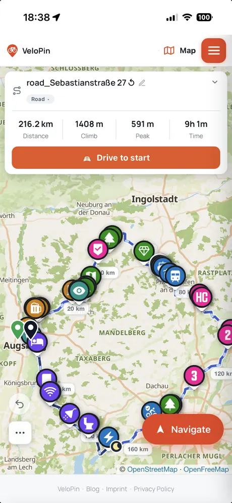
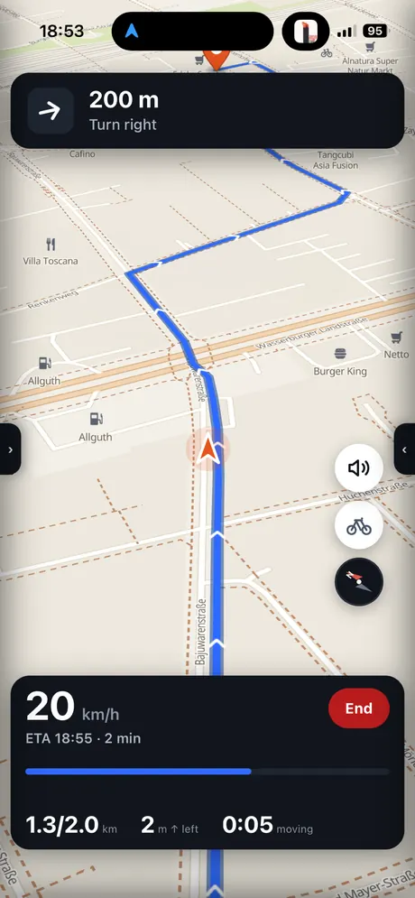
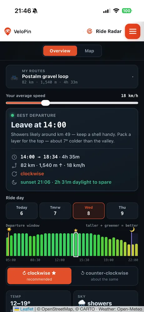
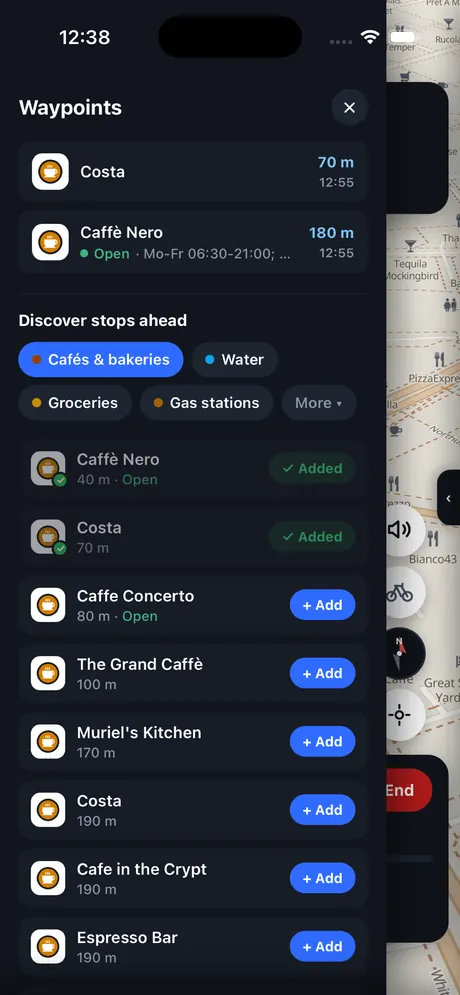
Plan on a big screen, ride with your phone
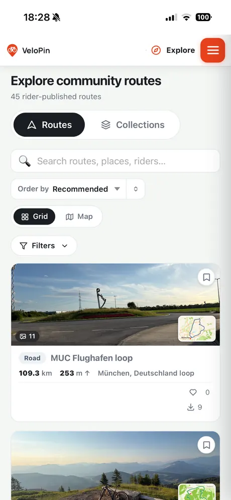
The workflow is the whole point. At home or at your desk you build the route in VeloPin: draw it, drop your cafe and water stops, check whether it is paved or gravel, and see the climbs. Save it to your route library and it syncs to your phone. When you head out, you open the app, pick the route and start navigating. Nothing to re-create, nothing lost in a file export - the plan you made is the ride you get.
Turn-by-turn navigation that keeps your waypoints
This is where most hand-offs fall apart. You export a GPX, and the cafe you carefully marked arrives as a nameless dot, or vanishes. Because VeloPin plans and navigates in the same place, your waypoints keep their names and notes on the ride. You get clear turn-by-turn cues, distance to the next turn and your live speed, and the stops you planned are still the stops you see - the right icon, the right note, at the right moment.
A ride companion in your pocket
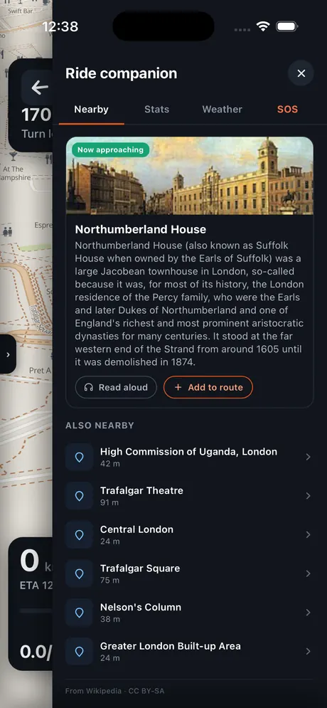
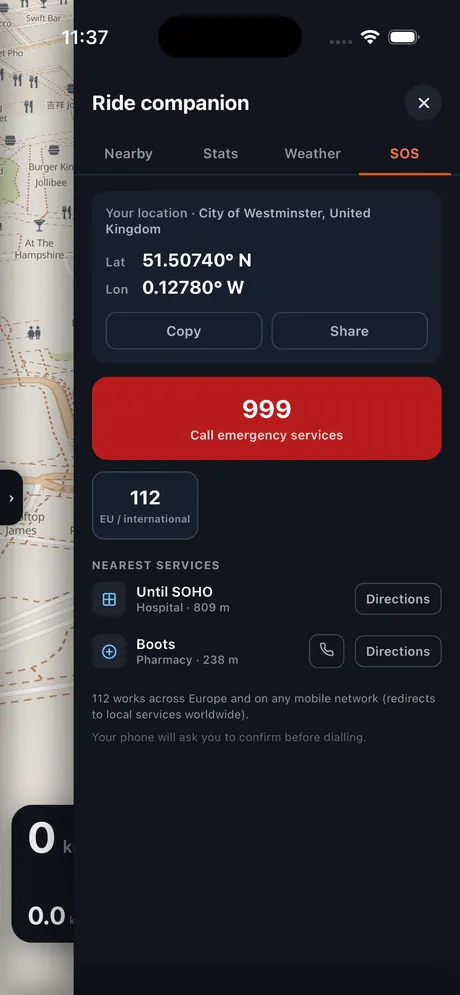
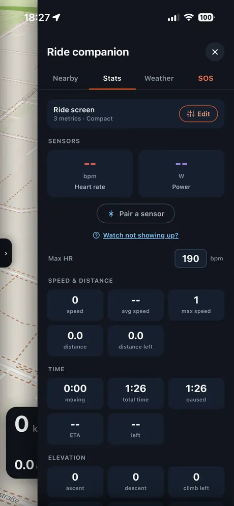
Tap into the ride companion and the phone becomes a proper bike computer. Live stats - speed, distance, climb, time - and sensor support if you pair a heart-rate or power meter. A Nearby tab surfaces cafes, water and points of interest around you, with opening hours and a read-aloud description so you can keep your eyes on the road. A Weather tab, and an SOS panel that shows the nearest services and lets you call for help fast when it matters.
Ride Radar: leave at the right time
The app carries Ride Radar too, so the weather question moves from the desk to the road. It reads rain, wind and daylight along your actual route and points you at the best departure window, then keeps an eye on conditions while you ride. Leaving at 14:00 instead of noon to dodge a shower is the kind of small call that saves a whole afternoon.
Every ride, logged
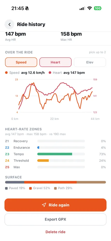
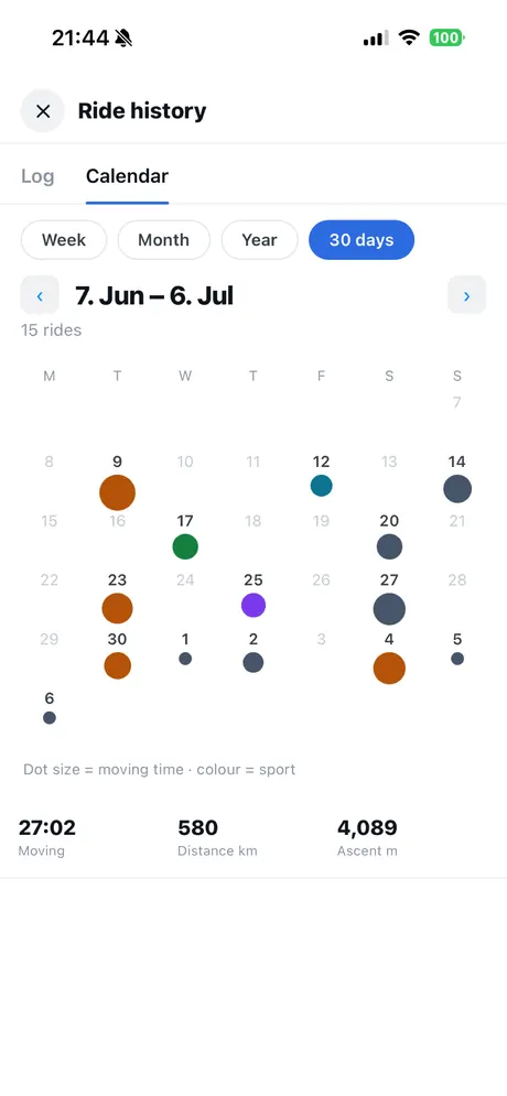
After the ride, it is all there in your history: distance, climb and moving time, heart-rate zones if you rode with a monitor, and a surface breakdown of where you actually went. A calendar view lays your rides out by day and effort, so a season adds up to something you can look back on rather than a pile of files.
From plan to ride, step by step
- Plan or import your route on a big screen in VeloPin, dropping the stops and waypoints you want.
- Save it to your VeloPin route library so it syncs to your phone.
- Download the VeloPin app from the App Store and sign in with the same account.
- Open your route in the app and start turn-by-turn navigation.
- On the ride, check nearby stops, live stats and the weather window from the ride companion.
- Back home, review the ride in your history - distance, climb, heart-rate zones and surface.
A navigation app you can pair with Komoot
If you already live in Komoot, you do not have to switch to gain from this. Komoot is great at discovery and community routes; where VeloPin earns its place is turning a plan into a faithful ride and getting waypoints onto your phone and head unit exactly as you set them. Plan or discover wherever you like, then navigate with the tool that keeps your stops intact. If you are weighing the two, the Komoot and RideWithGPS comparison lays out where each one shines.
New to VeloPin? Start with how VeloPin works, plan a route in the browser, then take it with you.
Frequently asked questions
Is there a VeloPin app for iPhone?
Yes. VeloPin is on the App Store for iPhone. You plan routes in your browser on any computer, and the same routes open in the app so you can navigate them on the bike. The app is free to download, with VeloPin Pro available inside for device export and the advanced features.
Can I use VeloPin as a bike navigation app instead of Komoot?
You can. Bring a route into VeloPin and navigate it with turn-by-turn guidance, and unlike a plain GPX hand-off your waypoints keep their names and notes on the ride. Komoot is still excellent for discovery and its own navigation - plenty of riders use both, planning or discovering in one and navigating with the tool that keeps their stops intact.
Do I need an account or a signal to navigate?
You can plan without an account. To ride, sign in so your routes sync from your library to the app, and your saved routes are ready when you set off. Navigation follows the route you loaded, so a patchy signal on the road does not leave you guessing.
What does the app do on the ride?
Turn-by-turn navigation that follows your waypoints, a ride companion with live stats and sensors, nearby cafes, water and points of interest, Ride Radar weather timing, an SOS panel with the nearest services, and a full ride history with heart-rate zones and a surface breakdown.