Mountainbike-Tour nach Rosskopf
● MTB rundkursbei Wildschönau, AT·geteilt von @pedals_and_pretzels
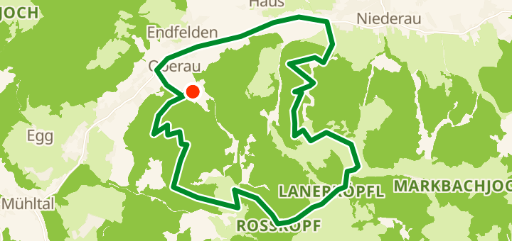
16 km893 mRundkurs1 wegpunkte
16 km
Distanz
893 m
Höhenmeter
1
Wegpunkte
MTB
Untergrund
Mit VeloPin Pro landen deine Wegpunkte mit den richtigen Symbolen und Notizen auf Garmin, Wahoo, COROS oder Karoo, statt als namenlose Punkte.
Nur den Routen-Track laden (.gpx)Über diese Route
This is a 16 km mountain-bike loop starting and ending around Wildschönau, AT. The route features 893 m of total climbing, making it very hilly and mountainous. The farthest point of the loop stays close to the start area. Attention: Significant bike & hike section to Rosskopf.
Höhenprofil
↑ 893 m Anstieg gesamt
Wegpunkte 1
Rosskopf
Gipfel
Auf einen Blick
- GeländeHügelig — 893 m / 16 km
- FormRundkurs
- Ideal fürMTB
- Stopps1 wegpunkte
Untergrund-Mix
Asphalt 19% · 2,9 kmUnbefestigt / Erde 3% · 0,5 kmSchotter 27% · 4,1 kmUnbekannt 51% · 8 km