Birmingham
● Gravel boucleprès de Birmingham, GB·partagé par @pedals_and_pretzels
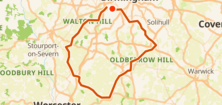
105 km1 356 mBoucle6 points
105 km
Distance
1 356 m
Dénivelé
6
Points
Gravel
Revêtement
Avec VeloPin Pro, vos points arrivent avec les bonnes icônes et vos notes sur un Garmin, Wahoo, COROS ou Karoo, au lieu de simples points sans nom.
Télécharger seulement la trace (.gpx)À propos
This gravel loop of 105 km starts and ends around Birmingham, GB. It features 1356 m of gently rolling climbing, heading out toward Wychavon, GB, before returning to the start.
Profil altimétrique
↑ 1 356 m dénivelé total
Points 6

Umberslade Farm Park
Site touristique

BP
Station-service
En bref
- TerrainVallonné — 1 356 m / 105 km
- TypeBoucle
- Idéal pourGravel
- Arrêts6 points
Types de revêtement
Bitume / Goudron 16% · 16,8 kmNon revêtu / Terre 9% · 9,5 kmGravier 1% · 1,1 kmInconnu 74% · 77,9 km