Gravel-Tour nach Radweg zum Sylvensteinspeicher
● Gravel boucleprès de Gaißach, DE·partagé par @pedals_and_pretzels
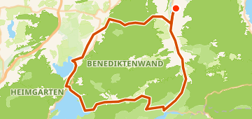
82 km1 170 mBoucle4 points
82 km
Distance
1 170 m
Dénivelé
4
Points
Gravel
Revêtement
Avec VeloPin Pro, vos points arrivent avec les bonnes icônes et vos notes sur un Garmin, Wahoo, COROS ou Karoo, au lieu de simples points sans nom.
Télécharger seulement la trace (.gpx)À propos
This is an 82 km gravel loop starting and ending in Gaißach, Germany. It features 1159 m of total climbing, with a gently rolling profile.
Profil altimétrique
↑ 1 170 m dénivelé total
Points 4

Esso
Station-service

Blick auf die Insel Sassau
Point de vue
En bref
- TerrainMontagneux — 1 170 m / 82 km
- TypeBoucle
- Idéal pourGravel
- Arrêts4 points
Types de revêtement
Bitume / Goudron 36% · 29,1 kmNon revêtu / Terre <1% · 0,8 kmGravier 50% · 40,5 kmInconnu 14% · 11,3 km