Durchs Naturjuwel Valepp – Durchs Naturjuwel Valepp Runde von Schliersee
● Gravel rondjebij Schliersee, DE·gedeeld door @pedals_and_pretzels
80 km1.076 mRondje2 waypoints
80 km
Afstand
1.076 m
Hoogtemeters
2
Waypoints
Gravel
Ondergrond
Met VeloPin Pro komen je waypoints met de juiste iconen en notities op een Garmin, Wahoo, COROS of Karoo, in plaats van als naamloze punten.
Alleen de route-track downloaden (.gpx)Over deze route
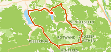
This 80 km gravel loop starts and ends around Schliersee, DE. The route features 1076 m of gently rolling climbing, with the farthest point of the loop near Bayrischzell, DE.
Hoogteprofiel
↑ 1.076 m totale klim
Waypoints 2

Trinkwasserstelle
Water

EDEKA xpress
Boodschappen
In het kort
- TerreinGolvend — 1.076 m / 80 km
- VormRondje
- Ideaal voorGravel
- Stops2 waypoints
Ondergrond-mix
Asfalt / Verhard 47% · 37,5 kmOnverhard / Aarde 4% · 3,2 kmGrind 41% · 32,7 kmOnbekend 8% · 6,4 km