Isartal – Blick ins Karwendeltal Runde von Jachenau
● Gravel loopnear Lenggries, DE·shared by @pedals_and_pretzels
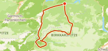
101 km1,839 mLoop9 waypoints
101 km
Distance
1,839 m
Elevation gain
9
Waypoints
Gravel
Surface
With VeloPin Pro your waypoints arrive with the right icons and your notes on a Garmin, Wahoo, COROS or Karoo, instead of as nameless dots.
Just download the route track (.gpx)About this route
Diese Schotterrundstrecke ist 101 km lang und beginnt sowie endet in Lenggries, DE. Die Route ist hügelig mit insgesamt 1928 Höhenmetern. Der äußerste Punkt der Schleife befindet sich nahe Scharnitz, AT.
Elevation profile
↑ 1,839 m total climb
Waypoints 9

Parkplatz an der Isar Vorderriß
Parking

Isartal
Waypoint
At a glance
- TerrainHilly — 1,839 m / 101 km
- ShapeLoop
- Best forGravel
- Stops9 waypoints
Surface mix
Asphalt / Paved 33% · 33.6 kmUnpaved / Dirt 1% · 1 kmGravel 54% · 54 kmUnknown 12% · 12.2 km