Gravel-Tour nach Dachstein Südwand — Day 2
● Gravel point à pointprès de Ebensee, AT·partagé par @pedals_and_pretzels
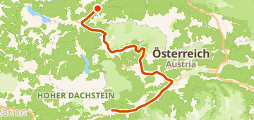
104 km1 356 mPoint à point7 points
104 km
Distance
1 356 m
Dénivelé
7
Points
Gravel
Revêtement
Avec VeloPin Pro, vos points arrivent avec les bonnes icônes et vos notes sur un Garmin, Wahoo, COROS ou Karoo, au lieu de simples points sans nom.
Télécharger seulement la trace (.gpx)À propos
This gravel point-to-point ride runs from Ebensee, AT to Haus im Ennstal, AT. The route covers 104 km with 1356 m of total climbing, featuring gently rolling terrain.
Profil altimétrique
↑ 1 356 m dénivelé total
Points 7

Radweg entlang des Rettenbachs
Point

Water fountain
Eau
En bref
- TerrainVallonné — 1 356 m / 104 km
- TypePoint à point
- Idéal pourGravel
- Arrêts7 points
Types de revêtement
Bitume / Goudron 62% · 64,4 kmGravier 21% · 22,2 kmInconnu 17% · 17,9 km